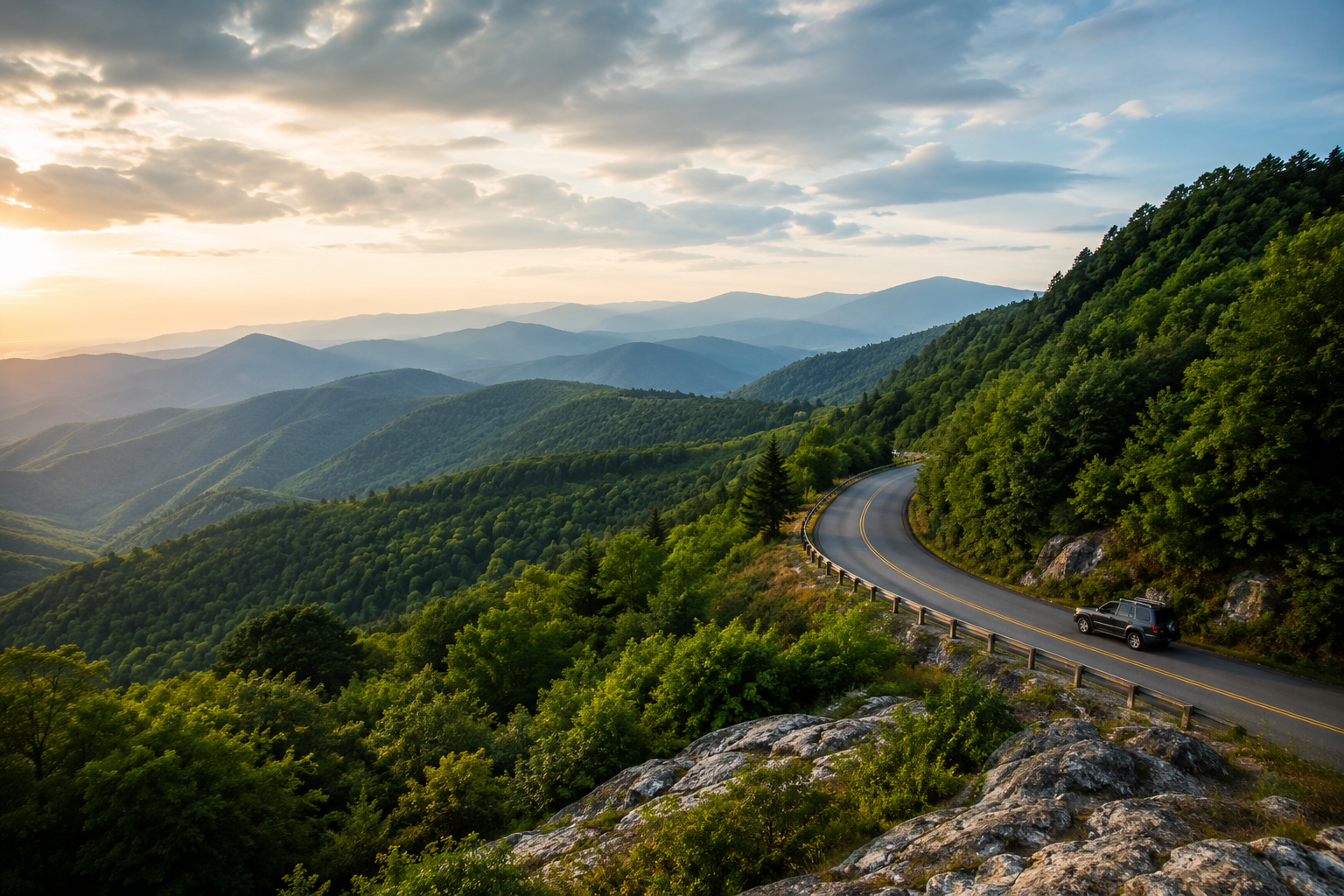
A Blue Ridge Parkway road trip is best done in about 5 days for first-time visitors, giving you enough time to combine scenic overlooks, short hikes, waterfalls, and mountain towns without turning the trip into a mileage race. This itinerary runs north to south, starting near Rockfish Gap, Virginia and finishing in the Asheville area of North Carolina, with stops across both states along the way. It’s built for couples, families, hikers, and photographers who want a real day-by-day plan rather than a general list of attractions. Before you go, check the National Park Service’s Blue Ridge Parkway road-status page, since sections of the route are still recovering from storm damage and conditions can change.
Blue Ridge Parkway Road Trip at a Glance
The Blue Ridge Parkway itself runs 469 miles from Rockfish Gap, Virginia (Milepost 0) to Cherokee, North Carolina (Milepost 469), linking Shenandoah National Park to Great Smoky Mountains National Park. This 5-day itinerary doesn’t try to cover the entire road at highway speed it breaks the drive into manageable daily sections built around overlooks, short walks, and towns just off the route.
| Day | Route | Main Highlights | Overnight Area |
|---|---|---|---|
| 1 | Rockfish Gap to Peaks of Otter (MP 0–86) | Humpback Rocks, Yankee Horse Ridge, Otter Creek, Abbott Lake | Peaks of Otter / Bedford |
| 2 | Peaks of Otter to Fancy Gap area (MP 86–199) | Sharp Top hike, Roanoke overlooks, Smart View, Mabry Mill | Galax / Fancy Gap |
| 3 | Virginia into the NC High Country (MP 199–294) | Blue Ridge Music Center, Doughton Park, Moses H. Cone Park | Boone / Blowing Rock |
| 4 | Boone to Little Switzerland area (MP 294–334, with a detour) | Linn Cove Viaduct, Rough Ridge, Linville Falls | Little Switzerland / Marion |
| 5 | Little Switzerland to Asheville (with a detour to MP 355+) | Mount Mitchell, Craggy Gardens, Asheville | Asheville |
Total driving distance: roughly 330–360 Parkway miles, plus some highway detour miles (see the closures section below)
Best months: May–October, with September–October for fall color
Best for: first-time visitors, couples, families, hikers, and photographers
Difficulty: easy driving, with optional moderate-to-strenuous hikes.
Reservations recommended: yes, especially for fall weekends and Asheville lodging
If you want to extend the trip beyond the Parkway itself, several nearby East Coast national parks, including Shenandoah to the north and Great Smoky Mountains to the south, pair naturally with this route for a longer outdoor-focused vacation.
Is 5 Days Enough for the Blue Ridge Parkway?
Five days is enough to drive a meaningful, scenic portion of the Blue Ridge Parkway while still stopping for hikes, waterfalls, and towns; it is not enough to leisurely cover all 469 miles end to end. For context:
- 2–3 days covers a shorter stretch at a faster pace, with fewer hikes and more time behind the wheel.
- 5 days (this itinerary) balances driving with stops, giving you 1–2 easy or moderate hikes most days and full mornings or afternoons in towns like Boone or Asheville.
- 7+ days or more allows a slower, hiking-focused trip that covers nearly the full length of the Parkway, with built-in rest days.
For most first-time visitors starting near Shenandoah and ending near Asheville, 5 days is the sweet spot between “we saw everything from the car” and “we never left the mountains.”
Which Direction Should You Drive the Blue Ridge Parkway?
Neither direction is objectively better; the right choice depends on your starting point, flights, and what you want to see last.
North to South
Driving from Rockfish Gap toward Asheville follows the natural progression this itinerary uses. It works well if you’re combining the Parkway with Shenandoah National Park beforehand or the Great Smoky Mountains afterwards, and it builds toward Asheville’s food and lodging scene as a strong finish.
South to North
Starting in Asheville and driving north suits travelers flying into Asheville Regional Airport or those who want the high-elevation North Carolina scenery (Mount Mitchell, Craggy Gardens) early in the trip while they’re fresh. It can also make sense if fall foliage is progressing from higher to lower elevations and you want to chase peak color northward.
Whichever direction you choose, check current road status first; closures can make one direction more practical than the other in a given season.
Day 1 — Begin the Blue Ridge Parkway Road Trip in Virginia
Driving: ~86 miles
Estimated road time: 2.5–3 hours without stops
Best hike: Humpback Rocks (moderate) or the Yankee Horse Ridge boardwalk (easy)
Best overlook: Sherando area overlooks near Milepost 16–20
Sleep near: Peaks of Otter or Bedford, Virginia
Start at Rockfish Gap (Milepost 0), near Waynesboro, where the Parkway picks up from Shenandoah National Park’s Skyline Drive. Your first stop is Humpback Rocks (Milepost 5.8), home to a reconstructed 19th-century mountain farmstead and a short interpretive trail; energetic travelers can continue on the steeper summit trail for sweeping valley views.
Continue south past Whetstone Ridge and the Sherando Lake area, stopping at overlooks as they appeal to you. This stretch of Virginia is quieter than the North Carolina sections and rewards unhurried driving. Around Milepost 34.4, pull off at Yankee Horse Ridge for a short boardwalk loop to Wigwam Falls, then continue to Otter Creek (Milepost 63.6), the Parkway’s lowest elevation point, for a streamside break.
End the day at Peaks of Otter (Milepost 85.6), where the easy, mostly flat Abbott Lake Loop makes a good sunset walk with Sharp Top Mountain reflected in the water. Overnight at Peaks of Otter Lodge if available, or in nearby Bedford or Roanoke.
If you have less energy or the weather turns: skip the Humpback Rocks summit climb and stick to the lower interpretive loop, and treat Yankee Horse Ridge and Otter Creek as your main stops for the day.
Day 2 — Peaks of Otter and Central Virginia
Driving: ~113 miles
Estimated road time: 3–3.5 hours without stops
Best hike: Sharp Top Mountain (strenuous) or the Abbott Lake Loop (easy)
Best overlook: Smart View, near Milepost 154
Sleep near: Galax or Fancy Gap, Virginia
Spend your morning at Peaks of Otter. The signature hike is Sharp Top Mountain, a roughly 3-mile round trip with a steep, rocky climb to a 360-degree summit view; a seasonal shuttle can carry less experienced hikers partway up. If a strenuous hike isn’t for you, the Abbott Lake Loop covers similar scenery with far less climbing.
By early afternoon, continue south past Roanoke, the largest city directly on the route, worth a short detour for lunch, then on to Smart View (Milepost 154.5), and Rocky Knob (Milepost 167) for classic Blue Ridge overlooks and easy loop trails.
Don’t miss Mabry Mill (Milepost 176), one of the most photographed spots on the Parkway, with a working water-powered gristmill and pond that’s especially scenic in early morning or golden-hour light. Wrap up near Groundhog Mountain and Fancy Gap, or continue to Galax, a good overnight base with more dining and lodging options than the route itself offers.
This day covers more driving than Day 1; if you’re travelling with young kids, consider trimming the between-stop mileage and treating Mabry Mill as your main afternoon destination rather than a quick photo stop.
Day 3 — Drive Toward Boone and the North Carolina High Country
Driving: ~95 miles
Estimated road time: 2.5–3 hours without stops
Best hike: Moses H. Cone Memorial Park carriage trails (easy to moderate)
Best overlook: Doughton Park
Sleep near: Boone or Blowing Rock, North Carolina
Leaving Galax or Fancy Gap, the Parkway crosses into North Carolina around Milepost 216.9. If it’s open when you visit, the Blue Ridge Music Center near the state line is worth a stop for anyone interested in Appalachian musical heritage.
Continue to Doughton Park (Milepost 238–245), one of the largest developed areas on the Parkway, with long-range overlooks and a network of trails through open meadows. The Northwest Trading Post nearby is a good, low-key stop for local crafts and snacks.
By afternoon, aim for Moses H. Cone Memorial Park (Milepost 294), where more than 25 miles of easy carriage roads wind past a historic manor house, now home to a Parkway craft shop. From here, it’s a short detour off the Parkway into Blowing Rock or Boone, both good overnight bases with far more restaurant and lodging variety than the route itself.
Note that several of today’s best stops, the town centers of Boone and Blowing Rock especially, require leaving the Parkway itself, which is normal for this section of the drive.
Day 4 — Boone, Linville Falls, and the Mount Mitchell Area
Driving: ~55 Parkway miles, plus a highway detour (see note below)
Estimated road time: 2.5–4+ hours depending on detour conditions
Best hike: Rough Ridge Trail (moderate) or Linville Falls Trail (easy to moderate)
Best overlook: Beacon Heights
Sleep near: Little Switzerland or Marion, North Carolina
This is the most scenic and currently the most complicated day of the trip. From Blowing Rock, rejoin the Parkway to reach the Linn Cove Viaduct (Milepost 304.4), the elevated S-curve bridge that wraps around Grandfather Mountain and one of the most photographed engineering features in the National Park System. The nearby Rough Ridge and Tanawha Trails offer excellent short-to-moderate hikes with boardwalks and rock-scramble sections.
Continue to Beacon Heights (Milepost 305.2) for a short hike to a rocky overlook, then to Linville Falls (Milepost 316.4), where an easy-to-moderate trail network leads to several viewpoints of the falls dropping into Linville Gorge. Choose one or two viewpoints rather than the full trail system; the falls area alone can fill an hour or two.
Important detour note: As of 2026, a stretch of the Parkway south of Linville Falls remains closed for ongoing storm-recovery construction related to Hurricane Helene, with the National Park Service targeting full reopening of the affected North Carolina sections by the end of 2026. If that section is still closed when you travel, you’ll need to detour off the Parkway using nearby highways such as US 221 and I-40 to continue toward Little Switzerland, Marion, or Asheville. Build extra time into this day and check the Parkway’s official road-status page the morning you leave.
Choose one: if you’d rather prioritize the hike over ground covered, spend more time at Rough Ridge and treat Linville Falls as a shorter stop, or vice versa trying to do both at full length in one afternoon is a common way this day runs long.
Day 5 — Asheville and the Southern Blue Ridge Parkway
Driving: varies with detour conditions; roughly 60–75 miles of scenic driving
Estimated road time: 3–4 hours without stops
Best hike: Craggy Pinnacle Trail (moderate)
Best overlook: Craggy Gardens
Sleep near: Asheville, North Carolina
If the Little Switzerland-to-Mount Mitchell section is open, continue south to Mount Mitchell State Park (accessible via NC Highway 128 near Milepost 355), home to the highest peak east of the Mississippi at 6,684 feet, with short trails through spruce-fir forest near the summit. From there, Craggy Gardens (Milepost 364) is famous for its Catawba rhododendron blooms in June, and the short Craggy Pinnacle Trail delivers a 360-degree view for a modest climb.
If that section remains closed for construction, use the highway detour from Day 4 to reach Asheville directly, then decide whether to pick the Parkway back up toward Craggy Gardens or spend the extra time in the city instead.
Most 5-day travelers wrap up the trip in Asheville (around Milepost 382–393), which deserves at least a half-day for its food, breweries, and the Biltmore Estate grounds the Parkway runs alongside. Travelers with extra time can continue south past Mount Pisgah (Milepost 408.6) and Waterrock Knob (Milepost 451.2) toward the Great Smoky Mountains entrance near Cherokee.
Best Stops on the Blue Ridge Parkway
| Stop | Best For | Time Needed | Difficulty |
|---|---|---|---|
| Humpback Rocks (MP 5.8) | History + views | 30–90 min | Easy to moderate |
| Peaks of Otter / Abbott Lake (MP 85.6) | Families, sunset | 30 min–half day | Easy |
| Mabry Mill (MP 176) | Photography | 30–45 min | Easy |
| Doughton Park (MP 238–245) | Long-range views | 30–90 min | Easy |
| Moses H. Cone Park (MP 294) | Families, easy walking | 1–2 hours | Easy |
| Linn Cove Viaduct (MP 304.4) | Photography, engineering | 30–60 min | Easy |
| Linville Falls (MP 316.4) | Waterfalls | 1–2 hours | Easy to moderate |
| Craggy Gardens (MP 364) | Wildflowers, sunset | 30–90 min | Easy to moderate |
| Blowing Rock / Boone | Town detour, dining | Half day | Easy |
Best Hikes Along the Blue Ridge Parkway
| Trail | Distance | Difficulty | Trail Type | Best Reason to Hike |
|---|---|---|---|---|
| Abbott Lake Loop (MP 85.6) | ~1 mile | Easy | Loop, paved | Family-friendly lake views, sunset light on Sharp Top |
| Yankee Horse Ridge (MP 34.4) | Under 0.5 mile | Easy | Boardwalk | Quick waterfall stop for any energy level |
| Linville Falls Trail (MP 316.4) | 1–4 miles depending on route | Easy to moderate | Out-and-back | Multiple waterfall viewpoints |
| Rough Ridge Trail (MP 302.8) | ~2.8 miles round trip | Moderate | Out-and-back, boardwalk | Boardwalk views near Grandfather Mountain |
| Craggy Pinnacle Trail (MP 364) | ~1.4 miles round trip | Moderate | Out-and-back | 360-degree summit views, rhododendron season |
| Sharp Top Mountain (MP 85.6) | ~3 miles round trip | Strenuous | Out-and-back | Panoramic summit views, optional shuttle |
Trail conditions, seasonal closures, and shuttle availability change, so confirm current details on official National Park Service or Forest Service trail pages before you hike, especially in areas still recovering from storm damage.
Where to Stay During a Blue Ridge Parkway Road Trip
Lodging along the Parkway is limited, so most travelers stay in nearby towns and drive back onto the route each morning.
Virginia (Peaks of Otter / Roanoke area): Peaks of Otter Lodge sits directly on the Parkway at Milepost 86; Roanoke and Bedford offer more hotel variety a short drive off-route.
Northern North Carolina (Boone / Blowing Rock): Both towns sit just off the Parkway near Moses H. Cone Park with a wide range of hotels, inns, and short-term rentals.
Central Parkway (Little Switzerland / Linville / Marion): Smaller, quieter lodging clusters here, useful for Day 4 if you’re detouring around closures near Linville Falls or Mount Mitchell.
Southern Parkway (Asheville): The largest concentration of hotels, cabins, and vacation rentals on this itinerary, and a good place to add an extra night.
On-Parkway lodging is limited and highly seasonal; nearby towns offer the widest variety; campgrounds and rustic cabins are available at several recreation areas but typically only in warmer months. Operating seasons vary by year, so confirm dates and current rates directly with lodges, hotels, and campgrounds rather than relying on outdated pricing.
Where to Eat and Get Fuel
The Blue Ridge Parkway is a scenic route, not a commercial highway; there are no fast-food chains or gas stations along most of the road. A few practical rules help:
- Fill your tank before each day’s drive, since fuel stations are typically in towns just off the Parkway rather than on it.
- Food options directly on the route are limited to a handful of seasonal restaurants, camp stores, and picnic areas; pack snacks and a full water bottle for each day.
- Download offline maps before entering longer stretches without cell service, particularly in the more remote Virginia and central North Carolina sections.
- Know the name of the nearest town before starting a long unbroken stretch, so you’re not searching for options once your fuel gauge is already low.
Best Time for a Blue Ridge Parkway Road Trip
| Season | Weather | Crowds | Best For | Main Drawback |
|---|---|---|---|---|
| Spring | Mild lower down, cool and variable at high elevation | Low to moderate | Wildflowers, fewer crowds | Possible high-elevation closures or cold snaps |
| Summer | Warm, green landscapes | High on weekends | Long daylight hours, family trips | Afternoon thunderstorms, weekend traffic |
| Fall | Crisp, cool at elevation | Highest of the year | Fall foliage, photography | Heavy weekend crowds, lodging books up early |
| Winter | Cold, occasional snow and ice | Lowest | Solitude, dramatic views | Real possibility of weather-related road closures |
Wildflowers peak at different times by elevation in spring, and mountain weather can still swing cold above 3,000 feet, so pack layers regardless of the valley forecast. Summer brings long daylight hours but also weekend crowds and fast-moving afternoon storms. Fall foliage is the Parkway’s biggest draw and its most crowded, hardest-to-book season color timing shifts every year and moves from higher to lower elevations over several weeks, so check current foliage reports rather than relying on a fixed date. Winter offers quiet, dramatic scenery but comes with real weather-closure risk at higher elevations, often with little notice.
Blue Ridge Parkway Road Closures and Current Conditions
This is one of the most important sections to read before you go. Always check the official National Park Service Blue Ridge Parkway road-status page in the days before departure and again each morning of your trip, since conditions can change quickly.
As of 2026, parts of the Parkway are still recovering from major damage caused by Hurricane Helene in September 2024, which triggered dozens of landslides and washed out road sections, primarily in North Carolina between roughly Linville Falls and Mount Mitchell. The Park Service is completing repairs in phases, with the remaining North Carolina sections targeted for full reopening by the end of 2026. Until then, expect:
- Full closures on some sections between Linville Falls and Mount Mitchell, requiring a highway detour
- Heavy construction traffic, including dump trucks and reduced speed zones, on open sections near Asheville and Mount Mitchell
- Occasional weather closures at high elevations even outside winter
- Seasonal or construction-related closures on spur roads to specific attractions
Beyond storm recovery, the Parkway also closes sections for routine winter weather, general construction, and occasional storm damage elsewhere along the route. Never assume the entire Parkway is open; always verify current conditions close to your travel dates rather than relying on this or any other article for real-time status.
How Much Does a Blue Ridge Parkway Road Trip Cost?
There’s no entrance fee to drive the Blue Ridge Parkway itself, so most of your budget goes toward fuel, lodging, food, and any side attractions off the route.
| Travel Style | Relative Budget |
|---|---|
| Camping/budget | Lowest |
| Mid-range hotels | Moderate |
| Cabins/premium stays | Higher |
Camping keeps costs to fuel, campground fees, and groceries. Mid-range travel adds hotel stays in towns like Galax, Boone, and Asheville plus restaurant meals. Premium travel might include cabin rentals, the Peaks of Otter Lodge, or extra nights in Asheville. Factor in extra fuel for detours around closures, entrance fees for off-Parkway attractions like Grandfather Mountain or Linville Caverns, and rental car or travel insurance costs, if applicable.
What to Pack for the Blue Ridge Parkway
- Layered clothing: temperatures shift significantly with elevation
- A rain jacket, even in summer
- Comfortable hiking shoes with good grip
- A refillable water bottle
- Snacks for each day, since food stops are limited
- Offline maps downloaded in advance
- A phone charger or portable power bank
- Basic first-aid supplies
- Sunscreen
- Insect repellent
- Binoculars for wildlife viewing
- A camera for overlooks and waterfalls
- A warm layer even in late spring or early fall
- Basic emergency supplies for the vehicle, including a flashlight and blanket
Driving and Safety Tips
- Don’t rush the rout;e the Parkway is designed for a slower pace, with a 45 mph speed limit and frequent curves.
- Use designated overlooks to stop for photos; never stop in an active travel lane.
- Watch for wildlife on and near the road, especially at dawn and dusk.
- Allow more time than a standard map estimate suggests, since overlooks and short hikes add up quickly.
- Check the weather forecast for higher elevations separately from valley towns, since conditions can differ sharply.
- Keep your fuel tank above a safe minimum, particularly before longer stretches between towns.
- Avoid distracted driving on curves with limited visibility.
- Use offline navigation in areas with limited cell service.
- Check road conditions each morning of the trip, not just before you leave home.
Common Blue Ridge Parkway Road Trip Mistakes
Trying to Drive Too Far Each Day
The Parkway rewards stopping, not covering ground; a day built around three or four meaningful stops usually beats one built around maximum mileage.
Planning Too Many Hikes
One major hike plus a few short overlooks and walks is usually enough for a single day; stacking multiple moderate-to-strenuous trails leads to rushed visits or late arrivals at your next stop.
Assuming Food and Fuel Are Everywhere
Unlike an interstate highway, the Parkway has long stretches without gas stations or restaurants; plan fuel stops around towns, not around the route itself.
Ignoring Elevation
Weather can change quickly as you climb from valley towns to ridge-line overlooks, even within the same day.
Booking Nothing During Fall
Popular towns like Boone, Blowing Rock, and Asheville can sell out well in advance during peak foliage weekends.
Trusting Drive Time Alone
A route that looks like two hours on a map can easily become most of a day once you add overlooks, short hikes, and photo stops.
Ignoring Closure Notices
Given ongoing storm recovery in North Carolina, treat this itinerary as flexible and be ready to adjust routes based on current road status rather than what a map app assumes is open.
FAQs
How many days do you need for a Blue Ridge Parkway road trip?
Most first-time visitors do well with 5 days, which allows time for scenic driving, a few hikes, waterfalls, and overnight stops in towns along the way. Two to three days works for a faster trip covering less ground, while a week or more suits a slower, hiking-focused visit.
Which direction is best for driving the Blue Ridge Parkway?
Neither direction is objectively better. North to south (Virginia to Asheville) suits travelers pairing the trip with Shenandoah or the Smokies, while south to north works well for those flying into Asheville or who want high-elevation North Carolina scenery early in the trip.
What is the prettiest section of the Blue Ridge Parkway?
Many travelers point to the stretch around the Linn Cove Viaduct, Grandfather Mountain, and Linville Falls in North Carolina, along with Craggy Gardens near Asheville. However, Virginia’s Peaks of Otter area is a close favourite for its lake-and-mountain combination.
Can you drive the Blue Ridge Parkway in one day?
Driving the full 469 miles in one day is possible only if you skip nearly every stop, and it isn’t recommended given the winding, 45 mph route. Most one-day visitors instead choose a shorter section rather than the entire Parkway.
What is the best month to drive the Blue Ridge Parkway?
October is popular for fall color, but it’s also the busiest month and the hardest to book lodging. May, June, and September offer a good balance of open facilities, milder crowds, and pleasant weather.
Is the Blue Ridge Parkway free to drive?
Yes, there is no entrance fee or toll to drive the Blue Ridge Parkway itself. Some attractions accessible from the route, such as Grandfather Mountain or Linville Caverns, do charge separate admission.
Where should you stay on a Blue Ridge Parkway road trip?
Most travelers stay in towns just off the Parkway, such as Roanoke, Galax, Boone, Blowing Rock, Little Switzerland, and Asheville, since on-route lodging is limited and highly seasonal.
Are there gas stations on the Blue Ridge Parkway?
Very few fuel stations sit directly on the Parkway. Plan to fill up in nearby towns before each day’s drive rather than relying on finding a station along the route.
Is the Blue Ridge Parkway difficult to drive?
The road is well maintained with a low speed limit, but it has continuous curves, steep drop-offs in places, and limited guardrails in some sections, so it requires steady, unhurried driving rather than technical skill.
Does the Blue Ridge Parkway close in winter?
Yes, sections of the Parkway close regularly in winter due to snow and ice, particularly at higher elevations, and closures can happen with little advance notice.
Final Thoughts
A 5-day Blue Ridge Parkway road trip gives you a real route to follow: where to start, where to stop each day, which hikes fit your energy level, where to sleep, and how to adjust if weather or construction changes your plans. Use this itinerary as a flexible framework, not a fixed script. The Parkway rewards travelers who leave room to linger at an overlook, swap a strenuous hike for an easy one, or reroute around a closure without losing the trip.
Xplore Terrainz developed this itinerary using current National Park Service route information, road-condition guidance, official maps, trail information, and destination research. Road closures, weather, lodging availability, and attraction hours can change, so verify current conditions before traveling.