The Pacific Crest Trail runs approximately 2,650 miles from the U.S. Mexico border through California, Oregon, and Washington to the U.S. Canada border. A complete PCT hike normally requires several months, extensive physical preparation, permits, reliable navigation, and the ability to manage desert heat, mountain snow, limited water, wildfires, and changing trail conditions.
Most thru-hikers travel northbound and begin in late April or early May. Southbound hikers generally start in late June or early July. Anyone traveling at least 500 continuous miles may apply for the free interagency PCT Long-distance Permit, although quotas apply to popular starting locations and dates.
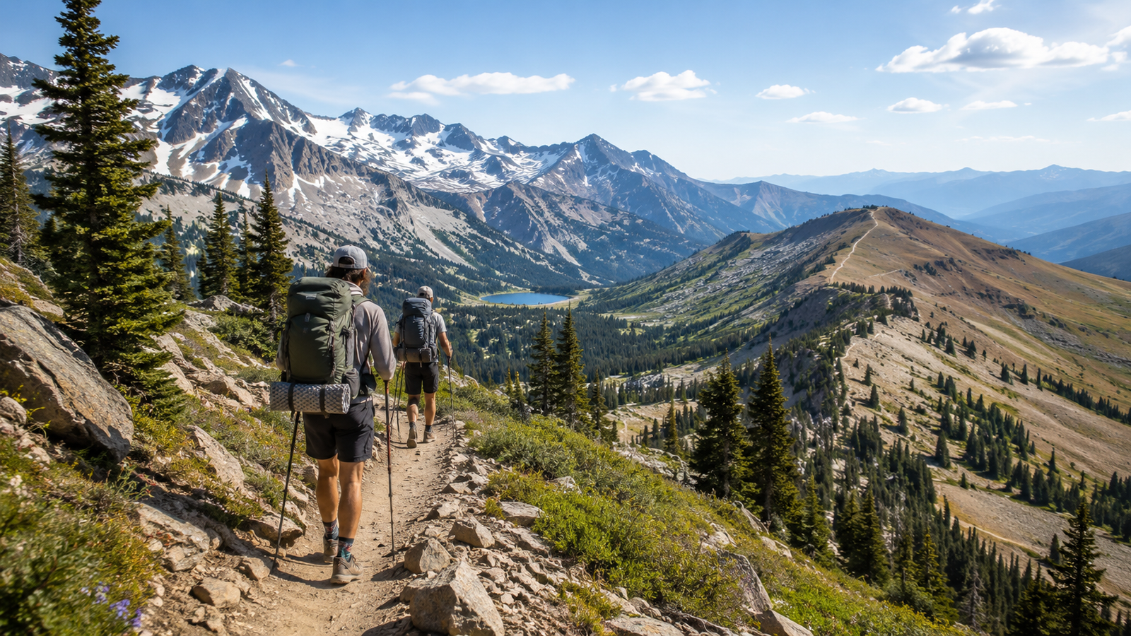
You do not need to complete the entire trail to experience it. Day hikes, weekend trips, and shorter section hikes provide more realistic starting points for beginners who want to develop backpacking skills before considering a months-long journey.
Pacific Crest Trail Quick Facts
| Detail | Information |
|---|---|
| Commonly cited length | Approximately 2,650 miles |
| Current estimated length | Approximately 2,655.8 miles |
| States | California, Oregon, and Washington |
| Southern terminus | Near Campo, California |
| Northern terminus | U.S.–Canada border in Washington |
| Typical thru-hike time | Around four to six months |
| Common direction | Northbound |
| Long-distance permit eligibility | At least 500 continuous miles |
| Primary environments | Desert, Sierra Nevada, volcanic mountains, forests, and Cascades |
| General budget | Approximately $8,000–$12,000 or more |
| Best beginner approach | Day hike or manageable section hike |
The familiar Pacific Crest Trail length of 2,650 miles is a rounded planning figure. Because the route changes through relocations, restoration work, closures, and updated mapping, the Pacific Crest Trail Association estimated the trail at approximately 2,655.8 miles in 2024. For general trip planning, 2,650 miles remains the standard figure.
What Is the Pacific Crest Trail?
The Pacific Crest Trail, commonly called the PCT, is a National Scenic Trail stretching from the Mexican border to the Canadian border through the western United States.
The route connects several dramatically different environments:
- Southern California desert
- San Jacinto and San Bernardino mountains
- Mojave landscapes
- Sierra Nevada
- Northern California forests
- Volcanic regions of Oregon
- Columbia River Gorge
- Washington Cascades
- North Cascades wilderness
The trail is managed by the U.S. Forest Service in partnership with the National Park Service, Bureau of Land Management, California State Parks, the Pacific Crest Trail Association, and other land managers. It is open to hikers and equestrians but not to bicycles or motorized recreational travel.
The PCT is not a continuous chain of developed campgrounds. Much of the route passes through remote backcountry where hikers carry their own shelter, food, water-treatment system, clothing, navigation tools, and emergency equipment.
How Long Is the PCT?
The commonly accepted answer to how long the PCT is is approximately 2,650 miles, or around 4,265 kilometers.
State-by-state measurements previously published by the Pacific Crest Trail Association include:
| State | Approximate trail distance |
|---|---|
| California | 1,691.7 miles |
| Oregon | 455.2 miles |
| Washington | 505.7 miles |
These measurements may not total the exact current route because the trail is regularly rerouted, repaired, and recalculated. Mileage displayed in navigation apps may also differ slightly from signs, guidebooks, and older maps.
A thru-hiker should not treat the total distance as the only challenge. Daily effort is also affected by:
- Elevation gain and loss
- Snow-covered passes
- River crossings
- Heat
- Long water carries
- Wildfire closures
- Resupply detours
- Rest days
- Illness or injury
- Difficult trail surfaces
- Weather delays
A five-month itinerary requires consistent movement over many weeks. Hikers often begin with shorter days while their bodies adapt and gradually increase mileage when trail conditions allow.
Main Sections of the Pacific Crest Trail
The PCTA organizes the trail into five broad regions: Southern California, Central California, Northern California, Oregon, and Washington. Each requires different equipment, timing, and skills.
1. Southern California
General route: Mexican border to the southern Sierra Nevada
Primary challenges: Heat, limited water, exposed terrain, and occasional mountain snow
Best known for: Desert landscapes, chaparral, San Jacinto, Big Bear, and long views
Many northbound thru-hikers begin near Campo, California, during spring.
Although commonly called the desert section, Southern California is not entirely flat or continuously hot. The PCT crosses several mountain ranges, including higher areas where snow and icy slopes may remain during spring.
Water planning is critical. The PCTA warns that some stretches may approach 30 miles between dependable water sources. Seasonal springs, tanks, and faucets can dry up, and hikers should never depend entirely on unofficial water caches.
New hikers often make the mistake of walking too far during their first week. A more sustainable approach is to begin conservatively, protect the feet, rest during extreme midday heat, and increase distance gradually.
2. Central California and the Sierra Nevada
General route: Kennedy Meadows South through the High Sierra and Yosemite region
Primary challenges: Snow, high passes, river crossings, cold nights, and food storage
Best known for: Granite mountains, alpine lakes, high-elevation scenery, and the John Muir Trail corridor
For many hikers, the Sierra Nevada is the most visually impressive and technically demanding section of the PCT.
Trail conditions depend heavily on the winter snowpack and spring temperatures. Entering too early may involve steep snow travel, difficult navigation, icy passes, and powerful creek crossings. Entering too late may create pressure to reach Washington before autumn storms.
Many hikers carry an ice axe and traction equipment when snow conditions require them. These tools are only helpful when the hiker has practised the relevant techniques before reaching dangerous terrain.
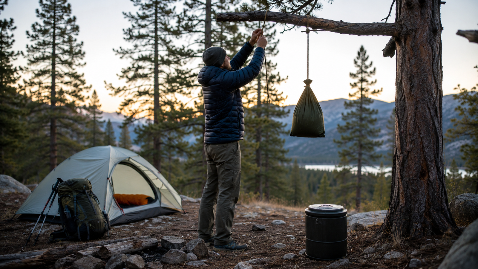
Bear-resistant food-storage canisters are mandatory in several areas along the PCT, including parts of the Sierra Nevada and all of Yosemite National Park. Where canisters are required, all food and scented items must fit inside an agency-approved model when camp is established.
3. Northern California
General route: Northern Sierra through volcanic landscapes to Oregon
Primary challenges: Heat, long distances, wildfire impacts, smoke, and mentally demanding terrain
Best known for: Lassen region, forests, lava landscapes, lakes, and views of Mount Shasta
Northern California is sometimes underestimated because hikers have already completed the desert and High Sierra. However, it represents a substantial portion of the journey.
The region includes lower, hotter sections as well as forested mountains and volcanic terrain. Wildfire damage can create fallen trees, overgrown tread, unstable slopes, missing signs, and longer detours.
In 2026, the PCTA continued to report post-fire trail damage in parts of the Northern Sierra, including significant fallen trees and vegetation growth in previous burn areas. Conditions evolve throughout the season, so hikers should use official closure and condition pages instead of relying solely on old trip reports.
4. Oregon
Approximate distance: 455 miles
Primary challenges: Mosquitoes, wildfire smoke, snow in early season, and repetitive forest terrain
Best known for: Crater Lake, Mount Hood, volcanic peaks, lakes, and generally smoother trail
Oregon is often considered one of the faster sections because parts of the trail have less extreme elevation change than the Sierra or Washington.
However, faster terrain does not eliminate risk. Early-season snow can obscure the trail, mosquitoes may be intense near lakes, and wildfire closures can affect major sections during dry summers.
Hikers should avoid planning unrealistic mileage simply because Oregon has a reputation for faster travel. Fatigue, smoke, heat, injury, and resupply logistics can still slow progress.
5. Washington
Approximate distance: 506 miles
Primary challenges: Steep climbs, rain, colder weather, remote terrain, and early snow
Best known for: Goat Rocks, Mount Adams, Mount Rainier views, Glacier Peak Wilderness, and the North Cascades
Washington delivers some of the trail’s most dramatic scenery but also introduces significant late-season risk.
Northbound hikers should plan to finish before winter weather reaches the North Cascades. The PCTA notes that snow has closed the Washington trail as early as mid-September in some years and advises planning to be off the route by October at the latest under normal conditions.
The official northern monument stands just inside the United States. Crossing into Canada directly from the PCT is prohibited. Since January 31, 2025, the former Canada PCT Entry Permit program has been discontinued, including for Canadian citizens. Hikers must plan a legal return route within the United States rather than continuing across the border.
How Long Does a PCT Thru-Hike Take?
Most complete thru-hikes take roughly four to six months, with approximately five months serving as a practical planning assumption for many hikers.
The total time depends on:
- Direction
- Start date
- Snowpack
- Hiking speed
- Number of rest days
- Injuries
- Wildfires
- Detours
- Weather delays
- Resupply frequency
- Experience level
Trips lasting longer than six months may encounter serious seasonal problems. A very early northbound start can place hikers in dangerous spring snow, while a slow northern finish can expose them to autumn storms and winter conditions.
A complete thru-hike should not be treated as 2,650 individual day-hike miles. The accumulated impact of repetitive movement, limited recovery, calorie demands, poor sleep, temperature changes, and mental fatigue makes long-distance hiking a different activity from an ordinary weekend trip.
Northbound, Southbound, or Flip-Flop?
Northbound PCT Hike
More than 90% of thru-hikers travel northbound. The PCTA generally recommends beginning a northbound trip in late April or early May, depending on snow conditions in Southern California and the Sierra Nevada.
Advantages
- Larger trail community
- More established seasonal flow
- Generally easier early terrain than the North Cascades
- Increasing fitness before reaching the Sierra
- More active hiker services and trail towns
Challenges
- Crowded southern sections
- Limited permit dates
- Desert heat
- Pressure to enter the Sierra at a suitable time
- Need to reach Washington before winter
A northbound start that is too early can place hikers on dangerous snow around San Jacinto and other Southern California mountains. It can also lead to an early Sierra arrival while high passes remain snow-covered and streams are swollen.
Southbound PCT Hike
Most southbound hikers begin from the Harts Pass area in Washington during late June or early July.
Because entering the United States from Canada on the PCT is illegal, southbound hikers typically start in the United States, hike north to visit the terminus, and then turn around to begin the southbound journey. Access may be delayed when snow blocks the road to Harts Pass.
Advantages
- Fewer hikers
- Greater solitude
- Cooler Southern California travel in fall
- Alternative for people unable to obtain a northbound permit
Challenges
- Immediate snow travel in the North Cascades
- More difficult navigation early in the trip
- Shorter weather window
- Seasonal services may close before arrival
- Water sources can be less reliable in Southern California during fall
Southbound hikers should aim to reach Kennedy Meadows South by late September or early October because significant Sierra snowfall commonly begins in October.
Flip-Flop PCT Hike
A flip-flop divides the trail into connected segments completed in a non-linear order.
For example, a hiker may:
- Begin in Northern California.
- Travel north toward Washington.
- Return later to complete Southern California.
- Reconnect all travelled sections into one continuous route.
This strategy may help avoid dangerous snow, reduce pressure from a fixed seasonal window, and spread hikers more evenly across the trail. Permit rules can become more complicated, and some returned sections may require separate local permits.
Pacific Crest Trail Permit Requirements
Permit requirements are one of the most important parts of planning.
PCT Long-Distance Permit
Hikers and equestrians travelling 500 or more continuous miles in one trip may apply for the interagency PCT Long-distance Permit.
The permit:
- Is free
- Covers many permitted areas along the trail
- Is issued to one adult
- Can include accompanying children under 18
- Is limited to one permit per person each year
- Requires the holder to begin at the approved location and date
- Must be printed and carried as a physical paper document
The long-distance permit does not create unlimited access to every side trip, campsite, or off-trail area. Hikers must continue following the individual laws and regulations of every park, forest, wilderness, and state-managed property they enter.
Current Permit Quotas
Current permit limits include:
- 50 permits per day for northbound trips starting south of Sonora Pass
- Northbound thru-hike dates from March 1 through May 31
- No northbound permits starting south of Sonora Pass during June
- 15 permits per day for trips beginning near the Canadian border
- Southbound thru-hike dates from June 15 through July 31
- A total annual limit of 8,000 long-distance permits
Popular start dates may be claimed quickly. Permit application and registration dates change each season.
For 2027 trips, the PCTA announced registration periods beginning in October 2026, with permit release days scheduled for November 4, 2026, and January 13, 2027. Applicants should not book non-refundable travel until the permit has been reviewed and approved.
Southern Sierra Rules
Long-distance permit holders must complete the Southern Sierra section between Kennedy Meadows South and Sonora Pass continuously, without changing direction or skipping parts of the route. Under current permit terms, this section must be completed within 35 days.
Local Permits
A PCT Long-distance Permit is not available for ordinary trips shorter than 500 continuous miles.
Section hikers must obtain permits from the local agencies responsible for the areas they plan to enter. Permit requirements vary and may include:
- Trailhead quotas
- Overnight wilderness permits
- Campsite-specific permits
- Self-issued permits
- National park reservations
- Food-storage requirements
Thirty-three areas along the PCT have their own permit systems, representing approximately one-third of the trail.
California Campfire Permit
Most California PCT hikers using a camp stove must carry a valid California Campfire Permit.
The permit does not automatically allow a campfire. Fire restrictions, seasonal closures, and local regulations still determine whether flames or stoves may legally be used. Oregon and Washington do not use the same California permit, although hikers may need to complete local self-issued permits when passing permit boxes.
Best Time to Hike the Pacific Crest Trail
There is no single month when the entire trail is simultaneously free from desert heat, mountain snow, wildfire risk, and early winter weather.
Broadly:
- Low-elevation California is most comfortable during spring and fall.
- Mountain sections are generally best during summer and early fall.
- Snow can cover major mountain sections from October or November into early July.
- Southern California can become dangerously hot during summer.
- Washington may receive early-season snow during September.
Recommended Northbound Window
Late April to early May
This timing attempts to balance:
- Southern California temperatures
- Snow in the desert mountain ranges
- Sierra Nevada snowmelt
- Stream levels
- The need to reach Washington before autumn
The exact timing changes every year. A low-snow winter does not guarantee safe stream crossings, while a high-snow year may delay suitable travel considerably.
Recommended Southbound Window
Late June to early July
Southbound hikers must wait for enough snow to melt in the North Cascades while still preserving enough time to cross the Sierra before major autumn storms.
This creates a narrow window and makes the southbound route better suited to hikers with strong navigation, snow-travel, and high-mileage experience.
How to Plan PCT Resupply
Most hikers do not carry months of food from the beginning.
The PCTA states that hikers can generally purchase food every four to ten days. It recommends buying from communities along the route and mailing boxes only to selected remote locations where store options are limited.
Main Resupply Methods
Buying Food in Town
Advantages:
- Select food based on current appetite
- Avoid shipping costs
- Support local communities
- Change the plan when mileage shifts
- Reduce the number of missed packages
Disadvantages:
- Smaller stores may have limited options
- Prices can be higher
- Special diets may be difficult to manage
- Seasonal stores may close
Mailing Resupply Boxes
Advantages:
- Better control over nutrition
- Useful for allergies or specialised diets
- Access to preferred products
- Helpful at remote locations
Disadvantages:
- Shipping is expensive
- Post office hours can cause delays
- Appetite may change
- Plans may shift because of closures or injury
- Hikers can become tired of pre-selected meals
A balanced approach is usually more practical: buy food in well-stocked towns and mail a small number of carefully planned packages to remote destinations.
Hiker Boxes
Some hostels, shops, and trail services maintain hiker boxes where hikers leave usable food and supplies they no longer need.
These boxes may contain fuel, oatmeal, snacks, sunscreen, or other supplies, but they are unpredictable. They should supplement a resupply plan rather than replace it.
Water Planning on the PCT
Water management changes by section and season.
Southern California contains long dry stretches, while mountain regions may contain frequent streams that become dangerous during snowmelt. Water sources listed in older guides can disappear, become contaminated, or stop flowing.
The crowdsourced PCT Water Report provides observations submitted by hikers and equestrians. However, it does not cover every section and cannot guarantee that a reported source will still be available when the next hiker arrives.
Water-Planning Rules
- Carry more capacity than the minimum expected need.
- Check multiple recent reports.
- Treat natural water.
- Never depend on a cache.
- Consider the distance to the next reliable source.
- Account for cooking and dry camping.
- Begin hot sections early.
- Rest during extreme midday heat.
- Know the symptoms of dehydration, heat illness, and hyponatremia.
Some Southern California stretches may require water carries approaching 30 miles. These sections demand fitness, experience, and realistic knowledge of individual water consumption.
Essential Gear for a PCT Hike
A complete gear list depends on season, direction, experience, and current conditions.
Before purchasing specialised equipment, review the Camping Essentials Checklist for Beginners for the fundamentals of shelter, sleep, clothing, cooking, lighting, and emergency preparation.
Core Backpacking Equipment
- Properly fitted backpack
- Lightweight tent, tarp, or other appropriate shelter
- Sleeping bag or quilt
- Insulated sleeping pad
- Water containers
- Water filter or treatment system
- Stove and fuel where permitted
- Food-storage system
- Headlamp
- First-aid supplies
- Navigation tools
- Sun protection
- Repair kit
- Emergency communication device
Clothing System
Carry layers suitable for:
- Desert heat
- Freezing mountain mornings
- Rain
- Wind
- Snow
- Strong ultraviolet exposure
A practical system may include:
- Sun shirt
- Hiking trousers or shorts
- Insulating layer
- Rain jacket
- Warm hat
- Sun hat
- Gloves
- Spare socks
- Sleep clothing
Snow Equipment
Depending on conditions, hikers may require:
- Ice axe
- Traction devices
- Waterproof socks or gaiters
- Additional insulation
- Snow-navigation tools
- Knowledge of self-arrest and safe route selection
Carrying an ice axe without training does not make steep snow travel safe.
Bear-Resistant Food Storage
Approved hard-sided bear canisters are required in multiple areas along the PCT. The container must be large enough to hold all food, trash, toiletries, and other scented items when camp is established.
How Much Does It Cost to Hike the PCT?
The Pacific Crest Trail Association estimates that a typical thru-hiker spends approximately $8,000 to $12,000 or more during the journey.
The final amount depends on:
| Expense | What affects the cost |
|---|---|
| Gear | Existing equipment, replacements, and specialised snow gear |
| Food | Appetite, dietary needs, and town prices |
| Lodging | Frequency of hotel, hostel, and campground stays |
| Transportation | Flights, buses, shuttles, and trailhead access |
| Insurance | Travel and medical coverage |
| Town meals | Restaurant frequency |
| Laundry and showers | Available services |
| Medical care | Injury, illness, or prescriptions |
| Shipping | Number of resupply boxes |
| Emergencies | Detours, closures, or unplanned time off |
The long-distance permit itself is free, but permits represent only a small part of the overall budget.
Running out of money is a commonly reported reason hikers leave the trail. Build an emergency reserve rather than budgeting only for ideal circumstances.
Training for the Pacific Crest Trail
A successful training plan should prepare the body for repetitive days rather than one unusually long hike.
Build a Walking Base
Begin with regular walking and gradually add:
- Distance
- Elevation
- Pack weight
- Uneven surfaces
- Consecutive hiking days
Complete Overnight Shakedown Trips
A shakedown trip reveals problems that are difficult to detect at home:
- Poor backpack fit
- Inadequate insulation
- Uncomfortable sleeping pad
- Tent setup problems
- Excessive pack weight
- Insufficient water capacity
- Footwear issues
- Missing repair supplies
Practise Required Skills
Before beginning a long-distance trip, hikers should know how to:
- Navigate without cell service
- Treat water
- Repair basic equipment
- Set up shelter in wind or rain
- Store food legally
- Recognise heat illness
- Respond to hypothermia
- Cross streams safely
- Turn back from unsafe conditions
- Use snow equipment when required
- Communicate an emergency
PCTA guidance suggests that many people spend six to eight months preparing, although individual planning periods vary considerably.
Wildfires, Closures, and Trail Conditions
Wildfire is now a central part of PCT planning.
A closure may require hikers to:
- Leave the trail
- Skip a section
- Arrange transportation
- Obtain new local permits
- Change resupply plans
- Wait for official information
- End the trip
Do not enter a closed area or attempt to improvise an unofficial route around a fire.
The PCTA maintains centralized trail-closure and condition resources, while local forests, parks, and emergency agencies issue the legally controlling orders. Check these sources before every section and again whenever communication becomes available.
Smoke can remain hazardous even when the trail itself is not closed. Hikers with respiratory or cardiovascular concerns should discuss exposure risks with a qualified medical professional before beginning the trip.
Is the Pacific Crest Trail Suitable for Beginners?
A complete thru-hike is not an ideal first backpacking trip.
The trail requires:
- Extended self-sufficiency
- Physical durability
- Navigation
- Water planning
- Weather assessment
- Food management
- Wilderness judgement
- Emergency decision-making
However, the PCT trail itself contains many day hikes, weekend routes, and manageable sections suitable for people building experience. Most visitors spend less than one week on the trail, and a person can explore it over many separate trips rather than attempting all 2,650 miles at once.
A sensible progression is:
- Complete several day hikes.
- Take a one-night backpacking trip.
- Complete a two- or three-night trip.
- Hike a one-week section.
- Attempt a longer section only after reviewing the previous experience.
- Consider a thru-hike after developing consistent backcountry skills.
Practical PCT Planning Timeline
Nine to Twelve Months Before
- Decide between a thru-hike and section hike.
- Select northbound, southbound, or flip-flop.
- Estimate the total budget.
- Research permit eligibility.
- Begin physical conditioning.
- Study the five trail regions.
- Review international travel requirements where relevant.
Six to Eight Months Before
- Register for the correct permit release.
- Apply for the permit.
- Build the core gear system.
- Begin overnight practice trips.
- Develop a preliminary resupply strategy.
- Arrange insurance and financial access.
Three to Four Months Before
- Increase back-to-back hiking days.
- Finalise the shelter and sleeping system.
- Test water capacity.
- Research bear-canister requirements.
- Identify remote resupply locations.
- Review snow and stream-crossing skills.
One Month Before
- Confirm transport.
- Print approved permits.
- Check equipment condition.
- Share a trip and communication plan.
- Download offline maps.
- Review current trail closures.
- Confirm emergency contacts.
- Avoid making assumptions based on last year’s trail reports.
Final Week
- Check weather forecasts.
- Review fire restrictions.
- Confirm current water information.
- Inspect the stove and fuel system.
- Pack medications.
- Reassess starting pack weight.
- Update family or emergency contacts.
- Change the plan when conditions exceed your ability.
Frequently Asked Questions
How long is the Pacific Crest Trail?
The Pacific Crest Trail is commonly described as approximately 2,650 miles long. The PCTA’s more detailed 2024 estimate placed the route at about 2,655.8 miles, but the exact distance changes as the trail is rerouted and remapped.
How long does it take to hike the PCT?
Most complete thru-hikes take around four to six months. Approximately five months is a common planning assumption, but timing depends on direction, weather, snow, fitness, rest days, wildfires, and injuries.
Do you need a permit to hike the Pacific Crest Trail?
Permit requirements vary by location. Anyone completing at least 500 continuous miles may apply for the PCT Long-distance Permit. Shorter section hikers must obtain the required local permits for each managed area.
How much does a PCT thru-hike cost?
The PCTA estimates that a typical thru-hiker spends approximately $8,000 to $12,000 or more. Gear, transport, food, hotels, medical care, insurance, replacement equipment, and unplanned delays can increase the total.
Is the PCT suitable for beginners?
Short PCT day hikes and sections can be suitable for prepared beginners. A complete thru-hike should generally be attempted only after gaining experience with backpacking, navigation, water treatment, food storage, weather, and emergencies.
What is the best direction for hiking the PCT?
Northbound is the most common direction and usually begins in late April or early May. Southbound offers more solitude but starts with difficult North Cascades terrain and has a tighter weather window.
How many miles should you hike each day?
There is no single correct daily distance. New thru-hikers should begin conservatively and increase mileage as their fitness and recovery improve. A complete five-month journey requires consistent progress, but conditions should determine pace rather than a fixed mileage target.
Does the Pacific Crest Trail enter Canada?
The northern monument stands at the international border, but crossing into Canada directly on the PCT is prohibited. Hikers must remain in the United States and use a legal return route.
Can you hike only part of the PCT?
Yes. Most PCT visitors complete day hikes, weekend trips, or short sections rather than a full thru-hike. Trips under 500 continuous miles use local permit systems instead of the PCT Long-distance Permit.
Are bear canisters required on the PCT?
Bear canisters are required in several areas, including parts of the Sierra Nevada, Yosemite, the Lake Tahoe Basin, Desolation Wilderness, and Lassen Volcanic National Park. Requirements vary, so hikers must confirm the rules for every section.
Final Thoughts
The Pacific Crest Trail is not one uniform path with one climate, one difficulty level, or one planning method.
It combines:
- Desert heat
- Long water carries
- Snow-covered mountains
- High passes
- River crossings
- Forests
- Volcanic landscapes
- Wildfire zones
- Remote resupply points
- Changing permit systems
A successful PCT hike begins with a realistic understanding of personal ability.
Future thru-hikers should:
- Gain backpacking experience first
- Apply for the correct permits
- Budget for unexpected costs
- Train over consecutive days
- Monitor snow, water, fire, and closures
- Carry legally required food storage
- Avoid depending on water caches
- Build flexibility into the itinerary
- Turn around when conditions become unsafe
Completing all 2,650 miles is an extraordinary goal, but it is not the only meaningful way to experience the PCT. A carefully selected day hike or one-week section can provide the same mountain views, desert sunsets, trail communities, and sense of discovery without requiring several months away from everyday life.
Editorial Research Note
Xplore Terrainz reviewed current guidance from the Pacific Crest Trail Association and its interagency permit system. Permit dates, quotas, fire restrictions, border rules, trail closures, water availability, food-storage regulations, and transportation can change. Verify all requirements with the PCTA and the responsible land-management agency before beginning any section.