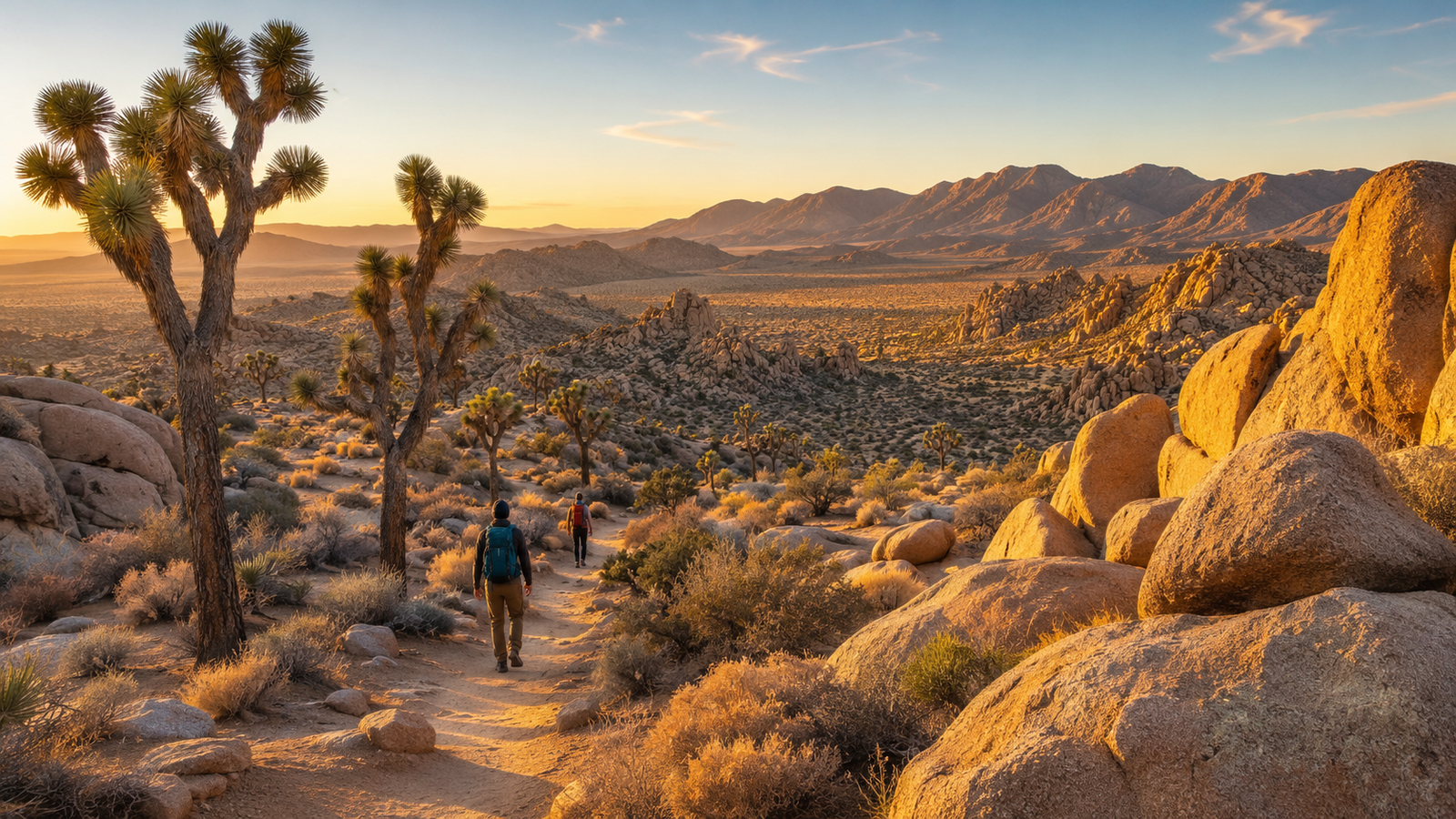
The best hikes in Joshua Tree range from one-mile nature loops between giant boulders to exposed desert climbs leading to panoramic mountain summits.
First-time visitors should begin with Hidden Valley, a one-mile loop that combines Joshua trees, rock formations, and an enclosed desert valley. Barker Dam is best for an easy, culturally rich walk, while Ryan Mountain is the strongest choice for hikers seeking a challenging summit view.
Joshua Tree National Park brings together two distinct desert environments: the higher Mojave Desert, where Joshua trees are most common, and the lower Colorado Desert, known for cholla cactus, ocotillo, and warmer conditions. The park’s hiking options reflect that variety, with routes through boulder fields, sandy washes, historic mining areas, palm oases, and high ridges.
This guide covers 11 of the best Joshua Tree hikes, including distances, difficulty, estimated time, major highlights, and practical planning advice.
Planning a broader national park trip? Our guide to the 15 Best National Parks in the USA for First-Time Visitors can help you compare Joshua Tree with other beginner-friendly destinations across the country.
Best Joshua Tree Hikes at a Glance
| Trail | Distance | Elevation change | Difficulty | Best for |
|---|---|---|---|---|
| Hidden Valley | 1 mile | 100 feet | Easy | First-time visitors |
| Barker Dam | 1.1 miles | 50 feet | Easy | History and desert scenery |
| Arch Rock | 1.4 miles | 100 feet | Easy | Rock formations and photography |
| Skull Rock Loop | 1.7 miles | 160 feet | Easy | Families and boulder exploration |
| Split Rock Loop | 2.5 miles | 150 feet | Moderate | Quieter rock landscapes |
| Lost Horse Mine | 4 miles | 550 feet | Moderate | Mining history |
| Ryan Mountain | 3 miles | 1,050 feet | Strenuous | Panoramic summit views |
| Fortynine Palms Oasis | 3 miles | 300 feet each way | Strenuous | Palm oasis scenery |
| Panorama Loop | 6.6 miles | 1,100 feet | Strenuous | Joshua tree forests and ridgelines |
| Warren Peak | 6.3 miles | 1,110 feet | Strenuous | Quiet mountain views |
| Willow Hole | 7.2 miles | Limited overall gain | Strenuous | Wonderland of Rocks scenery |
Distances, elevation changes, and estimated difficulty are based on current National Park Service trail information. Trail conditions can change following heat, flooding, maintenance, or temporary closures, so check current park alerts before departure.
1. Hidden Valley Nature Trail
Best Joshua Tree Hike for First-Time Visitors
Distance: 1-mile loop
Elevation change: Approximately 100 feet
Estimated time: About one hour
Difficulty: Easy
Trailhead: Hidden Valley picnic area
Hidden Valley is the best introduction to Joshua Tree National Park.
The trail enters a rock-enclosed valley surrounded by enormous monzogranite formations, Joshua trees, pinyon pines, junipers, yucca, and desert shrubs. The landscape changes quickly despite the short distance, making it feel more adventurous than a typical one-mile nature walk.
The path includes sections of sand, uneven rock, and a few stone steps, but it does not involve a long climb. Interpretive signs explain the plants, geology, and human stories connected with the valley.
Hidden Valley works particularly well for:
- First-time park visitors
- Families with older children
- Travelers with limited hiking time
- Photographers
- Visitors combining several short trails in one day
- Anyone wanting classic Joshua Tree scenery without a strenuous climb
The enclosed formations create many natural compositions for Joshua Tree National Park photos, especially during the softer light of early morning or late afternoon.
What to know before hiking
Hidden Valley is one of the park’s most popular locations. The National Park Service recommends visiting before 9 a.m. during busy periods, and the parking area may temporarily close when it reaches capacity.
Verdict
Choose Hidden Valley when you have time for only one easy trail and want the broadest introduction to Joshua Tree’s signature landscape.
2. Barker Dam Trail
Best Easy Hike for History and Desert Scenery
Distance: 1.1-mile loop
Elevation change: Approximately 50 feet
Estimated time: About one hour
Difficulty: Easy
Trailhead: Barker Dam parking area
Barker Dam combines natural scenery with the park’s ranching history.
The trail passes through boulder formations and Mojave Desert vegetation before reaching a small historic water-storage structure built by early cattle ranchers. The water level varies considerably, so visitors should not expect a fully reflective reservoir throughout the year.
Even when the dam is dry, the loop remains worthwhile because it includes:
- Joshua trees
- Large granite formations
- Open desert views
- Historic ranching infrastructure
- Cultural sites
- Potential wildlife activity
The trail requires minimal elevation gain and no intense scrambling, making it one of the more approachable Joshua Tree hiking trails. The National Park Service notes that bighorn sheep may occasionally be seen in the area, although sightings should never be expected or pursued.
Protect cultural sites
Remain on the established trail and do not touch, trace, wet, or mark rock art or other cultural resources. Historic and Indigenous sites are irreplaceable, even when previous visitors have already caused visible damage.
Crowd-management tip
Barker Dam is another location the park recommends visiting before 9 a.m. during high-demand periods. If the parking area is full, continue to another trail rather than creating an unofficial parking space.
Verdict
Barker Dam is an excellent choice for visitors who want an easy trail with more historical context than Hidden Valley.
3. Arch Rock Trail
Best Easy Hike for a Natural Rock Formation
Distance: 1.4 miles
Elevation change: Approximately 100 feet
Estimated time: About one hour
Difficulty: Easy
Trailhead: Twin Tanks parking area, also known as the Arch Rock Trailhead
Arch Rock is a naturally formed stone arch hidden among granite formations near White Tank Campground.
The official route begins at the Twin Tanks parking area. A roughly 0.6-mile approach leads to a short loop, with the arch located about halfway around that loop. The path crosses sandy and rocky terrain but remains manageable for most visitors comfortable walking on uneven ground.
The arch is not enormous, but its shape, surrounding boulders, and desert setting make it one of the park’s most recognizable photography locations.
Arch Rock is best for:
- A short morning or evening walk
- Families
- Desert photography
- Travelers exploring the Pinto Basin Road area
- Visitors staying near White Tank or Belle Campground
- Combining with the Cholla Cactus Garden
Photography advice
The small area around the arch can feel crowded when several groups arrive together. Avoid climbing directly beneath photographers, standing on fragile vegetation, or creating new paths around the formation.
For cleaner images, arrive early and frame the arch from several distances rather than waiting only for the most obvious close-up composition.
Verdict
Arch Rock is one of the best short walks in the park for travelers interested in unusual geology and accessible photography.
4. Skull Rock and Discovery Trail
Best Easy Hike for Families and Boulder Exploration
Distance: Approximately 1.7-mile loop
Elevation change: About 160 feet
Estimated time: One to two hours
Difficulty: Easy
Trailhead: Skull Rock parking area or Jumbo Rocks Campground
Skull Rock is a granite formation shaped by weathering into what resembles two eye sockets and a skull-like profile.
Many visitors stop beside the road, take a quick photograph, and leave. Completing the surrounding loop provides a much better experience.
The trail moves through:
- Desert washes
- Boulder piles
- Joshua trees
- Rock corridors
- Open sections near Jumbo Rocks
- The namesake Skull Rock formation
The Discovery Trail also connects areas around Skull Rock, Split Rock, and Face Rock, providing additional opportunities for short exploration. The National Park Service classifies the Skull Rock route as an easy 1.7-mile loop and the Discovery Trail as a 0.7-mile loop through boulder piles and washes.
Is Skull Rock worth visiting?
Yes, but the roadside formation itself is frequently crowded. The surrounding trail is the more rewarding part of the stop, as it lets you experience the boulder landscape beyond the photo area.
Safety note
Children often want to climb the rocks, but granite surfaces can be steep, abrasive, and difficult to descend. Scrambling differs from following the maintained loop, and falls can occur even near the road.
Verdict
Skull Rock is a strong family-friendly option when you want an easy trail with plenty of natural features to keep the walk interesting.
5. Split Rock Loop
Best Moderate Hike for Quieter Boulder Scenery
Distance: 2.5-mile loop
Elevation change: Approximately 150 feet
Estimated time: 1.5–2.5 hours
Difficulty: Moderate
Trailhead: Split Rock picnic area
Split Rock Loop provides a quieter alternative to Hidden Valley and Skull Rock.
The route travels through boulder fields, washes, desert vegetation, and broad rock corridors. The formations feel larger and more immersive once you move away from the parking area, yet the trail remains short enough for a half-day itinerary.
The official distance includes the safe route to Face Rock and involves relatively limited elevation change.
Split Rock is best for:
- Hikers seeking fewer people
- Boulder photography
- Visitors are comfortable following a less obvious desert trail
- A moderate morning hike
- Combining with nearby Skull Rock
- Exploring without committing to a summit climb
Navigation considerations
Rocky desert terrain can make trails difficult to distinguish. Watch for signs, trail markers, and obvious footpaths rather than following every set of footprints.
Download the park map before entering because cell service is extremely limited or nonexistent in many parts of Joshua Tree. The park recommends carrying an offline map plus a physical map and compass as backup.
Verdict
Split Rock is one of the most underrated moderate Joshua Tree hikes for visitors who want boulder scenery without the largest crowds.
6. Lost Horse Mine Trail
Best Hike for Mining History
Distance: 4 miles out and back
Elevation change: Approximately 550 feet
Estimated time: Two to three hours
Difficulty: Moderate
Trailhead: Lost Horse Mine trailhead off Keys View Road
Lost Horse Mine leads to one of the park’s most significant surviving gold-mining sites.
The trail crosses open Mojave Desert terrain with broad views of surrounding mountains and valleys. The historic mill structure becomes visible near the end of the route, providing a tangible connection to the region’s mining period.
The hike is not technically difficult, but several factors make it more demanding than the short nature trails:
- Limited shade
- Exposed terrain
- Gradual climbing
- Loose and uneven surfaces
- Greater distance from busy visitor areas
- Potentially strong wind
The National Park Service lists the route as a four-mile out-and-back hike with about 550 feet of elevation change. Visitors must remain outside the fenced area to protect the mine and mill site.
Short route or full loop?
The four-mile out-and-back trail is the better choice for most visitors.
The complete Lost Horse Loop is approximately 6.5 miles and takes three to four hours. It provides a longer desert hike but adds exposure and navigation requirements without necessarily improving the mine experience for first-time visitors.
Crowd tip
Lost Horse Mine is popular during the cooler season, and its parking area may reach capacity. The park recommends arriving before 9 a.m. during busy periods.
Verdict
Choose Lost Horse Mine when you want a moderate hike that combines desert views with one of Joshua Tree’s most important historic sites.
7. Ryan Mountain Trail
Best Joshua Tree Summit Hike
Distance: 3 miles out and back
Elevation gain: Approximately 1,050 feet
Estimated time: 1.5–2.5 hours
Difficulty: Strenuous
Trailhead: Parking area between Sheep Pass and Ryan Campground
Ryan Mountain is one of the most popular and rewarding summit routes in the park.
The hike climbs steadily from the moment you leave the trailhead. Stone steps and a well-established path lead up the mountain’s exposed slope, with increasingly broad views across the Mojave Desert.
From the summit area, hikers can see:
- Lost Horse Valley
- Queen Valley
- Pinto Basin
- The Wonderland of Rocks
- Distant mountain ranges
- Extensive Joshua tree habitat
The three-mile distance may sound moderate, but gaining approximately 1,050 feet over a short route makes the climb physically demanding. The trail has little shade and should not be attempted during hot conditions.
Best time to hike Ryan Mountain
Start early during the cooler months.
Morning temperatures are safer, parking is easier, and visibility may be better before afternoon haze or wind develops. During summer or extreme heat, choose a short nature trail instead.
The National Park Service classifies Ryan Mountain among the strenuous hikes that should not be attempted during summer or whenever temperatures are high.
Who should skip it?
Ryan Mountain may not be appropriate for:
- Visitors unaccustomed to steep climbs
- Anyone without adequate water
- Hikers starting during midday heat
- Travelers with knee problems aggravated by steep descents
- Visitors relying on limited daylight
- Anyone feeling early symptoms of heat illness
Verdict
Ryan Mountain is the best overall summit option for hikers who want major views without committing to a full-day route.
8. Fortynine Palms Oasis Trail
Best Hike to a Desert Palm Oasis
Distance: 3 miles out and back
Elevation change: Approximately 300 feet in each direction
Estimated time: Two to three hours
Difficulty: Strenuous
Trailhead: Fortynine Palms parking area, accessed from Highway 62
Fortynine Palms Oasis leads over a rocky ridge and down into a canyon containing native California fan palms.
The route is unusual because it gains elevation in both directions. Hikers climb over the ridge on the way to the oasis, descend into the canyon, and then must climb back out before returning to the parking area.
The surrounding slopes contain barrel cactus, rocky outcrops, desert shrubs, and expansive views toward Twentynine Palms.
The oasis itself provides a dramatic visual contrast with the exposed desert. However, it is a sensitive wildlife habitat rather than a swimming or picnic destination.
The National Park Service lists the trail as a strenuous three-mile route and specifically advises avoiding it during hot weather.
Protect the oasis
Do not enter or contaminate the water. Desert animals depend on these limited water sources, and human activity can disturb wildlife or damage the surrounding soil and plants.
Heat risk
The return climb can feel much harder than the walk into the oasis. Begin early, carry enough water, and turn around before reaching the palms if temperatures or fatigue become a concern.
Verdict
Fortynine Palms is one of the best hikes in Joshua Tree for experiencing a natural oasis, but it should be reserved for cool weather.
9. Panorama Loop and Morongo View Trail
Best Hike Through Joshua Tree Forests
Distance: 6.6-mile loop
Elevation gain: Approximately 1,100 feet
Estimated time: Three to five hours
Difficulty: Strenuous
Trailhead: Black Rock area
Panorama Loop travels through one of the densest Joshua tree landscapes in the park before climbing toward the Little San Bernardino Mountains.
The route begins in sandy terrain and eventually reaches a ridgeline with wide views across the western park. Vegetation changes with elevation, introducing pinyon and juniper woodland in addition to Joshua trees.
Highlights include:
- Dense Joshua tree forest
- Sandy washes
- Ridge walking
- Mountain views
- Quieter surroundings
- Pinyon-juniper habitat
- Access from the Black Rock area
The official route is 6.6 miles with approximately 1,100 feet of elevation gain. The National Park Service estimates a three- to five-hour duration and classifies it as a strenuous hike that should not be attempted in hot conditions.
Important access note
Black Rock is separated from the main Park Boulevard corridor by a road. Drivers must leave the primary park route and approach the area through Yucca Valley, so include additional driving time in the itinerary.
Why hike here?
Many first-time visitors remain around Hidden Valley, Jumbo Rocks, and Keys View. Panorama Loop offers a quieter Joshua Tree hiking experience with greater elevation gain, changing vegetation, and fewer roadside stops.
Verdict
Choose Panorama Loop for a longer hike that emphasizes Joshua tree forests rather than boulder formations.
10. Warren Peak Trail
Best Quiet Desert Summit
Distance: 6.3 miles out and back
Elevation gain: Approximately 1,110 feet
Estimated time: Three to five hours
Difficulty: Strenuous
Trailhead: Black Rock area
Warren Peak is a quieter alternative to Ryan Mountain.
The trail climbs through the western side of the park toward a summit overlooking the Little San Bernardino Mountains, Black Rock Canyon, surrounding desert communities, and distant peaks.
Compared with Ryan Mountain, Warren Peak offers:
- A longer trail
- Fewer hikers
- More gradual variety
- Joshua tree and pinyon-juniper scenery
- A quieter summit experience
- Additional route combinations in the Black Rock trail network
The official route is approximately 6.3 miles with 1,110 feet of elevation gain. It is considered strenuous and should not be attempted during summer or other hot conditions.
Warren Peak vs. Ryan Mountain
Choose Ryan Mountain when you want:
- A shorter route
- Easier access from the main park road
- A classic first summit
- Broad central-park views
Choose Warren Peak when you want:
- More solitude
- A longer hike
- Black Rock scenery
- Joshua tree forests
- A quieter western-park experience
Verdict
Warren Peak is one of the best Joshua Tree hikes for experienced visitors seeking summit views without Ryan Mountain’s heavier foot traffic.
11. Willow Hole Trail
Best Long Hike Near the Wonderland of Rocks
Distance: 7.2 miles out and back
Estimated time: Approximately four hours
Difficulty: Strenuous because of distance, exposure, and navigation
Trailhead: Southern Boy Scout Trailhead inside the park
Willow Hole follows the edge of the Wonderland of Rocks through Joshua tree forests, sandy washes, and extensive boulder landscapes.
The route is less steep than Ryan Mountain or Warren Peak, but the distance, desert exposure, and potentially confusing terrain make it a serious hike.
The trail ends near a cluster of willow trees that indicates the presence of seasonal or underground moisture. Water should not be expected or treated as a reliable source.
The National Park Service lists the route as a 7.2-mile out-and-back hike that takes approximately 4 hours.
Why Willow Hole is challenging
The primary difficulties are:
- Long distance
- Limited shade
- Sandy walking
- Similar-looking desert terrain
- Weak or absent cell reception
- Greater distance from immediate assistance
- Hot conditions outside the coolest seasons
Stay on the established route. The Wonderland of Rocks contains complex formations and washes where hikers can quickly lose their sense of direction.
Alternative for experienced hikers
The full Boy Scout Trail covers approximately eight miles one way and enters deeper into the Wonderland of Rocks. Completing the entire route usually requires a shuttle, and the National Park Service notes that most hikers prefer to travel from the southern trailhead toward Indian Cove.
Willow Hole is the more practical choice for visitors who want to return to the same vehicle.
Verdict
Choose Willow Hole when you want a longer desert hike with immersive boulder scenery, but do not need a high summit.
Best Joshua Tree Hikes by Difficulty
Best easy hikes
Choose:
- Hidden Valley
- Barker Dam
- Arch Rock
- Skull Rock
- Cap Rock, as a shorter alternative
The National Park Service also identifies Hidden Valley, Barker Dam, Arch Rock, and Discovery Trail as popular easy hikes of roughly one mile.
Best moderate hikes
Choose:
- Split Rock Loop
- Lost Horse Mine
- West Side Loop
- Pine City
These routes offer more distance and exposure without the steep climbing required by the major summit trails.
Best strenuous hikes
Choose:
- Ryan Mountain
- Fortynine Palms Oasis
- Panorama Loop
- Warren Peak
- Willow Hole
Do not attempt strenuous routes during summer or whenever conditions are hot. Joshua Tree’s exposed terrain, limited shade, dry air, and scarce water make heat illness a serious risk.
Best Time for Joshua Tree Hiking
The best general periods for Joshua Tree hiking are:
- October through November
- February through April
- Cool days in December and January
Fall and spring typically bring daytime highs in the range of approximately 70–85°F, while winter days are often around 60°F with nights near or below freezing. Summer daytime temperatures commonly approach or exceed 100°F.
Spring
Spring provides comfortable hiking temperatures and potential wildflowers, but it is also the park’s busiest season.
Expect:
- Full parking areas
- Entrance lines
- Busy trails
- Limited campground availability
- Greater activity around popular attractions
Fall
Fall brings increasingly comfortable hiking weather, especially from October onward. Weekends and holidays can still be busy, but crowding is often more manageable than during peak spring-break periods.
Winter
Winter is excellent for longer trails when conditions are dry.
Prepare for:
- Freezing mornings
- Strong wind
- Shorter daylight
- Occasional snow at higher elevations
- Rapid temperature changes
Summer
Summer is not suitable for most long hikes.
The park recommends choosing short activities and beginning before 10 a.m. or after 4 p.m. during hot conditions. Visitors should carry at least one gallon of water per person per day, rest in shade where available, and recognize symptoms of heat illness.
Joshua Tree Hiking Safety
Carry more water than you expect to drink
There is no drinking water in the park’s interior. Fill containers before beginning the drive, and do not rely on reaching a water station after starting a trail.
For a long or exposed route, carry enough water to return safely even when the hike takes longer than planned.
Download maps before entering
Cell service is extremely limited and nonexistent in many areas.
Download the official NPS app and save Joshua Tree for offline use. Carrying a paper map provides additional protection if a phone battery dies or the device overheats.
Share your hiking plan
Tell someone:
- Which trail are you using
- Where you parked
- When you started
- Your expected return time
- When they should seek assistance
Do not change to a substantially longer trail without updating that person when communication is available.
Protect yourself from the sun
Use:
- Broad-spectrum sunscreen
- Wide-brimmed hat
- Sunglasses
- Lightweight long sleeves
- Lip protection
- Salty snacks
- Adequate water
High UV exposure can cause sunburn even when air temperatures feel comfortable.
Do not rely only on the trail distance
A three-mile desert trail can be more demanding than a longer shaded woodland route.
Consider:
- Elevation gain
- Sand
- Loose rock
- Heat
- Wind
- Lack of shade
- Navigation
- Distance from help
Leave pets off hiking trails
Pets are not permitted on Joshua Tree’s hiking trails, except on the paved Oasis of Mara trail. Leashed pets may be walked in campgrounds or on certain roads while remaining within 100 feet of a road.
Joshua Tree Entrance, Reservations, and Parking
As of July 2026, visitors do not need an advance reservation to enter Joshua Tree National Park. An entrance pass is required, and purchasing it online before arrival may reduce time at the entrance station.
The standard private-vehicle entrance pass currently costs $30 and remains valid for seven consecutive days.
Arrive early
During busy periods:
- Enter before 8 a.m.
- Visit Hidden Valley and Barker Dam before 9 a.m.
- Use the North or South Entrance when practical
- Avoid leaving immediately after sunset
- Visit on weekdays
- Move to another location when a parking lot is full
The West Entrance near the town of Joshua Tree is generally the busiest entrance.
Park legally
Use marked spaces or graded roadside shoulders where parking is permitted.
Do not:
- Drive onto desert soil
- Park in vegetation
- Block traffic
- Stop beside red curbs
- Create a space outside the designated area
Popular parking lots may temporarily close once they reach capacity.
Suggested One-Day Joshua Tree Hiking Itinerary
Easy first-time itinerary
Morning: Hidden Valley
Late morning: Barker Dam
Lunch: Designated picnic area
Afternoon: Skull Rock and Discovery Trail
Sunset: Cap Rock or Quail Springs
This itinerary provides classic boulders, Joshua trees, history, and sunset scenery without a strenuous climb.
Active hiking itinerary
Early morning: Ryan Mountain
Late morning: Short rest and meal
Afternoon: Split Rock Loop
Sunset: Keys View or Cap Rock
Do not add Ryan Mountain to a hot afternoon schedule.
Photography-focused itinerary
Sunrise: Arch Rock
Morning: Cholla Cactus Garden
Afternoon: Hidden Valley
Golden hour: Barker Dam or Cap Rock
After dark: Designated stargazing area
Check moonrise, weather, and road conditions before planning night photography.
Frequently Asked Questions
What is the best hike in Joshua Tree National Park?
Hidden Valley is the best hike for most first-time visitors because it provides Joshua trees, giant boulders, desert plants, and an enclosed valley within a manageable one-mile loop.
What is the best Joshua Tree summit hike?
Ryan Mountain is the best overall summit hike. It covers approximately three miles and gains about 1,050 feet in elevation, offering wide views across the park.
What is the easiest hike in Joshua Tree?
Cap Rock, Cholla Cactus Garden, and Bajada are among the shortest walks. Hidden Valley, Barker Dam, Arch Rock, and Discovery Trail are popular scenic options of approximately one mile.
How many days do you need for Joshua Tree hiking?
Two days are enough for several major short trails and one longer hike. Three days provide more flexibility for different park regions, changing weather, photography, and rest between strenuous routes.
Can beginners hike in Joshua Tree?
Yes. Hidden Valley, Barker Dam, Arch Rock, Skull Rock, Cap Rock, and Discovery Trail are suitable starting points for many beginners. Desert heat, uneven surfaces, and limited water still require preparation.
Is Ryan Mountain difficult?
Ryan Mountain is strenuous because it gains approximately 1,050 feet over a three-mile out-and-back route. The constant ascent, exposed terrain, and lack of shade make it significantly harder during warm weather.
Can you hike Joshua Tree in summer?
Short walks may be possible early in the morning or late in the evening, but long, strenuous hikes should not be attempted during extreme heat. Summer temperatures can exceed 100°F, and shade is extremely limited.
Are there waterfalls in Joshua Tree?
Joshua Tree is a desert park and does not have dependable recreational waterfalls. Barker Dam may hold water following suitable conditions, while palm oases indicate natural water availability, but neither should be treated as a swimming location.
Do you need a permit to hike in Joshua Tree?
Day hikers do not normally need a separate permit for the trails in this guide. Visitors need a park entrance pass, while backpacking, camping, commercial activities, and certain special uses have separate requirements. No advance reservation is currently required for the ordinary park entrance.
Are dogs allowed on Joshua Tree hiking trails?
Pets are generally prohibited from hiking trails. Oasis of Mara is the main trail exception identified by the National Park Service, and pets must remain leashed.
Final Thoughts
The best hikes in Joshua Tree are not necessarily the longest.
Hidden Valley delivers the strongest first-time experience within a 1-mile radius. Barker Dam combines accessible scenery with cultural history, while Arch Rock and Skull Rock offer easy boulder exploration.
For hikers seeking more challenge:
- Choose Lost Horse Mine for history
- Choose Ryan Mountain for a classic summit
- Choose Fortynine Palms for an oasis
- Choose Panorama Loop for Joshua Tree forests
- Choose Warren Peak for a quieter mountain
- Choose Willow Hole for a longer Wonderland of Rocks experience
Joshua Tree’s desert can appear open and approachable, but heat, poor navigation, minimal shade, and limited cell coverage make preparation essential.
Begin early, carry sufficient water, remain on established trails, and choose a route that matches the weather rather than the itinerary you originally hoped to complete.
Editorial Research Note
Xplore Terrainz reviewed current trail, safety, fee, reservation, and visitor-planning guidance from Joshua Tree National Park and the National Park Service. Trail access, parking, weather, closures, and restrictions can change. Check the official alerts and conditions page immediately before your visit.